What a great day! The owner of the Little Orleans Lodge is a lot like Paul, he doesn't sleep much either. So early this morning-6:15-ish, Steve took Paul up to Point Look Out. Steve promised Paul a view and it was quite a view. From this vantage pint, Paul could see the Potomac and the mountains that the canal had manged to avoid.
 All along the the C & O are hiker/biker camp sites. Each site has a pump among its amenities. Even though we are staying inside every night, Paul has not lost his touch.
 The Potomac continues its trip to the Chesapeake and is a joy to watch.
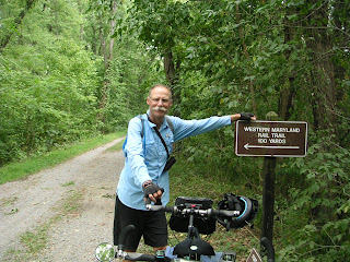
 About 10 miles beyond Little Orleans, we left the C & O and went on the Western Maryland Rail Trail.
  This rail trail is 23 miles of paved pleasure on the former Western Maryland Railroad.
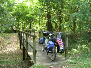
 However, there are connector bridges between the two trails and we left the WMRT to rejoin the C & O to see some of the history along the canal.
 These limekilns at the Round Top Cement Works produced tons of cement including some that was used to build the Washington Monument.
 This formation is called the Devil's Eyebrow. It is a geological formation called an anticline. The softer stone in the arch has eroded away leaving this shallow cave-like structure.
 Three miles later we were in Hancock. When in Hancock there are two "must do" places for us. One is the C & O Bicycle Shop. There Paul can peruse the bike goodies and there is always the opportunity to swap stories.
 The second spot is Weaver's. Finally Paul got some pie and frosting!
 Ten miles to the east of Hancock, the Western Maryland Rail Trail ends and we were back on the C & O. Near mile 108, locks 47-50 are one right after the other. This quick drop in elevation required this quick succession of locks and allowed the canal company to cut though a neck of land.
 Upstream from Dam #5, the canal used the river because of the rock face along the river's edge.
 This Dam # 5. During the Civil War, the Confederate Army tried to blow it up but were unsuccessful. The dam creates a large lake which kept a ready supply of water for the canal system. Even today, it helps with flood control.
 At mile 100, the Conococheague Aqueduct appears. And yes, I spelled it right and it really is a name that can be pronounced! It is missing one side which simply blew out one day. Unfortunately there was a boat in the aqueduct at the time.
 Mile 100 is also where Williamsport is. So our day on the canal ended.....and after we got to the motel, it rained!
Nothing beats the beauty of the East coast!
ReplyDeleteHi Guys,Will your route take on the C&O past Lock 7? We're right there and we'd love to come out and wave to you if the timing works.
ReplyDeleteWish we could travel to the end,but we are getting off the C&O at White's Ferry.
ReplyDeleteOk, just checking! Safe travels! XOXO
ReplyDeleteWe met Jane and Paul on C&O Canal just west of Shepherdstown this morning about 11:00 AM. Cindy & I were on C&O Bike Patrol (Volunteer program for National Park Service) this morning and had a pleasant chat with them. They're headed for Harpers Ferry, WV and Jane is looking for a post card from West Virginia. Good Luck Ed & Cindy on Bike Patrol.
ReplyDeleteAnother summer day
ReplyDeleteHas come and gone away
While Paul and I roam
But I wanna go home
Mmmmmmmm